It has taken nearly 2 years to try and put any words together about this hike. A day by day diary would be easy, we have that in our notebooks, but it didn't feel like that kind of walk. In fact it is a number of quite different walks stitched together to create a crossing. What follows is personal, far less about steep climbs or flowing contours and how far we traveled each day, but how it felt to us to wander the length of the Alps.
In Europe there is an equivalent to the British climbing retort to whatever anyone has achieved of "yes, but what have they done on grit" of "but where have you been in the Alps". We love the Pyrenees, whether it is scrambling up 3000m summits or trekking their entire length it is all fun and immersive but the question of the Alps kept coming back and wouldn't leave us alone.
Cicerones guide to the Alps lists 20 "classic" routes alone before we even started really looking, it was only then that we came upon the Via Alpina website which clearly stated "Discover the Alps", just what we needed to do!
We managed to negotiate a 100 day window away from our daily grind so figured the most direct way of the red route from Trieste to pick up the green route through Switzerland, before returning to the red route to finish somewhere on the French Mediterranean was doable. Our chosen route itself was made up of a who's who of Alpine trails; Slovenian Mountain Route 1 (apparently the oldest trail in Europe), Adria Alpe, Carnic Way, Via Alpe, Berliner/Peter Habler Hohenweg, Alpine Pass route, Tour du Mont Blanc, GR5, GR55 and the Grande Traversee du Mercantour. A bit greedy really!
Over the preceding winter we organised our kit, booked transport to and accommodation in Trieste, our starting point and bought the first few maps we would need to get us started. Then worked like mad to get the bills paid so we could go.
We had hoped at this point to put in some training too as we were well aware of how much the start of a long walk can hurt, but work, my Achilles injury and Jo's marathon training put paid to that. At least starting in June it couldn't possibly be as hot as the start to previous long hikes, could it?
We arrived in Trieste on 22 June 2017 in the midst of a European wide heat wave!
 |
| Trieste |
How was it? Well not only did we discover a little of the Alpine cultures and history of Slovenia, Italy, Austria, Germany, Liechtenstein, Switzerland and France, but we walked stunning ridges, high cols, hidden valleys and the occasional peak. We experienced temperatures from 40C down to -10C, storms that raged all night and day, rain that washed away trails and snow that covered the landscape in a brilliant silence. Bears, boars, wolves and great birds of prey, all manner of farm animals and grumpy dogs we survived it all. After hiking for 94 days we arrived in Menton having walked nearly 1800 km with more than 126 000 m of ascent and descent. ( Details
here ) Something similar to climbing Ben Nevis every day for 94 days with a big sack! But it wasn't all good which will be explained if you read on.
 |
| Wash day and map homework at Trenta campsite |
The sub title of this, "all by feet"?!, was uttered in amazement and or incredulity by a number of people we met along the way, not so much that long distance hiking is rare in the Alps, more that we were not taking advantage of buses and, more importantly, ski lifts when they coincided with our route. We hadn't even noticed that this was the case on the Via-Alpina website where on reflection it is obvious some sections make use of these mechanical means. Not us, it seemed like cheating on our through hike of discovery, although I can see the advantages when time is short, to hike what was described to us as "Via-Alpina lite".
So in terms of planning the
Via-Alpina website is a great place to start but be aware that buses and cable cars are used in the timings of some sections. Another consideration is the route itself, we found better trails higher up rather than the described route along the valley floor, with better planning and more time we could have made more of our route choices.
On the trail.
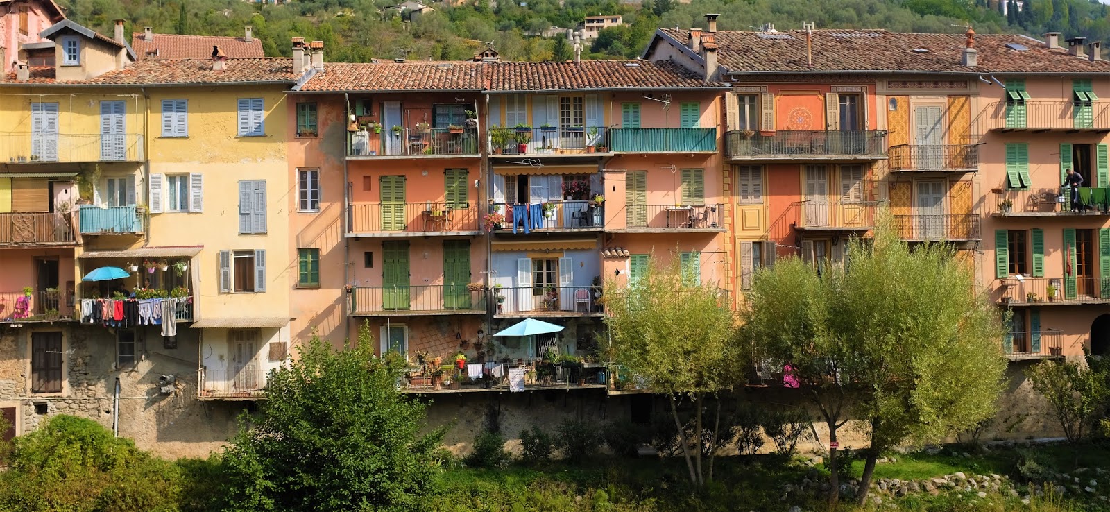
Coming from the UK with fairly scant knowledge of European history and all of that from an island British perspective we were immediately struck by Trieste, an Italian city with obvious Austrian influences. By the second day we entered Slovenia, once part of Yugoslavia and only in its current form since 1991. And so it went on throughout our journey much of the time following borders that had ebbed and flowed over the centuries marked by ancient forts and not so old trenches, barbed wire and concrete bunkers, constant reminders of a violent and fluid past.
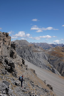
SLOVENIA is stunningly beautiful and the trail initially meanders through quiet pastoral countryside (and yes there are Bears in those woods!) on its way to the Julian Alps, a stark limestone contrast.
 |
| Skirting Vogel. |
 |
| Zasavska koca na Prehodavcih. |
In general the trails are clear and well marked. The Refuges we used were extremely friendly and served great food. The crux of this section is the fabulous ridge walk from Crna prst to Dom na Komni. We did not consider it difficult in any way as others have suggested however 3 dead cows struck by lightening attest to its exposure to storms. It can be done quite easily in a day from Crna prst but from Petrovo Brdo we had a somewhat uncomfortable bivy near Vogel and then wandered down to Dom na Komni for the most fabulous breakfast of chocolate pancakes. With continuing mixed weather we decided to leave Triglav for another time and continued through to Trenta with it's campsite and useful little shop.
Another day and we are in AUSTRIA.
After the excitement of the Julian Alps we struggled with the first few days in Austria meandering around in thick forestry where trails had been destroyed by felling operations, but things improved following Egger Alm. It was also somewhere here that I picked up a gastric bug that very nearly finished our hike. Unwell by the Zollnersee Hutte, I was having weird out of body experiences descending to a bivouac below Wolayersee Hutte. What followed for the next 3 days was worse and we holed up at Hochweinsteinhaus, if you were there at the same time then I am truly sorry. The Carnic Way (Karnischer Hohenweg) provides a fun few days of easy ridge traversing wanderings with great views into the Italian Dolomites, unfortunately I remember relatively little other than the kindness of staff at Hochweinsteinhaus, Peach sponge cake at Neue Porze Hutte and great coffee on a wet morning at Fillmoor Hut.
Austrian trails are consistently very well marked to the extent I think even we would struggle to get lost! The Refuges are run as mountain hotels where you are the guest and the staff are there to serve you, is that why we met so many French hikers here? 😂. On the flip side it can sometimes feel as though you are slowly and methodically being separated from your wallet.
 |
| Looking back to Hochweinsteinhaus. |
 |
| Views into Italy. |
 |
| Atmospheric. |
Not being able to eat for several days and then continuing with long days on the trail with limited resources made life difficult until some equilibrium was restored, unfortunately this would take a while.
ITALY was as beautiful as the views from the Carnic Way had suggested and despite the tourists and having seen many photos previously Tre Cime did not disappoint. The trails are well marked and there are some amazing refuges, relaxed, fun and loud with great food and coffee. But more than this the Italian Alps seem more egalitarian with a more relaxed attitude to bivouac and an excellent network of bivouac huts. Oh to be a little bit Italian!
 |
| Tre Cime. |
The following days were hard in my depleted state as we crossed ridge line after ridge line, long ups followed by long downs repeated day after day until we reached Taufers where we played several rounds of "supermarket dash" until we were so full we could hardly move let alone pick up our sacks!
 |
| A few hundred meters up out of Taufers. |
This is also one of the sections we had failed to spot the use of the cable car in the route description so we were now faced with far in excess of 1000m of ascent with very heavy packs!
Where the weather previously had been mixed, it had become significantly colder and more frequent storms that would continue for much of the coming couple of months. Yet the trails that lead us onward to Finkenberg were great. High stormy bivouacs, the utterly awesome Chemnitzer Hutte (Our favorite refuge of the hike), Brenninger Bivouac hut and the combination of Hohenwegs that contoured amongst the peaks until the last possible moment when cold and soaked we arrived in Finkenberg and were taken in by the very kind owners of Gastehaus Eberl.
 |
| Chemnitzer Hutte. |
 |
| Biwak W Brenninger, perfect port in a storm. |
 |
| Rest between storms, Berliner Hohenweg. |
Disappointingly things became increasingly developed again with only short sections of rugged terrain. However Schwaz provided not only food, maps and gas, but our first snowfall on 26 July, this was an indication of how the weather would be for the remainder of the trek.
The first crossing into Germany at the Meillerhutte was fun, steep scramble up to a bivy amongst the rocks before the refuge, and beautiful.
 |
| Rocky bivy below the Meillerhutte. |
 |
| Breakfast with a view over the Wetterstein mountains. |
Almost immediately back to Austria on a mix of trails before dropping into Oberstdorf to re-supply and pick up a new solar panel we had sent out from the UK.
 |
| Friendly natives. |
 |
| Looking back to Austria as we cross into Germany again. |
Having collected all we needed in Oberstdorf we headed back into Austria to make our connection with the Alpine Pass Route through Switzerland.
 |
| Bivouac. |
 |
| Austrian Breakfast view. |
 |
| On the way to Lichtenstein. |
Lichtenstein was an immediate shock to the pocket and a worry as to how we would manage financially through Switzerland. A rather forlorn girl at the refuge complained that hardly anyone ever stopped there, I didn't have the heart to explain the amount of electric fencing to be negotiated to get there coupled with the eye watering cost of half a radler was enough to put off most of the worlds population. Getting there we had already had a very long day trying to get through the urban areas from Buchboden to Feldkirch, which ended with us diverting to Nuziders for 2 nights at a campsite to get our kit clean and rest. Following this we had a Bivouac in Lichtenstein before another urban transition through Sargans and starting the "Green Route" proper, in the rain.
 |
| Heading down to Sargans. |
 |
| Cold and wet! |
Switzerland. Now we had both been looking forward to this section given all the glowing accounts of other peoples hikes along the Alpine Pass Route or as it appears to now be called Via-Alpina 1. (This apparent hijacking of the Via Alpina "name" seemed at odds with the values of a cross border hiking route). Undoubtedly some of the views are stunning, spectacular even, but for us the walking not so much. So many of the trails follow roads, tracks, next to railways, cable cars, bus routes and urban areas, yes the scenery is beautiful but for much of it there is a total disconnect between you and the mountains. We did not coin this phrase but "Alpine Bypass Route" accurately summed up how we felt by the time we rejoined the "Red Trail". Some pretty pictures though.
 |
| Surenen Pass. |
 |
| Planplatten. |
 |
| Bivouac sunset on the Bernese Alps. |
 |
| Eiger. |
 |
| Lauterbrunnen. |
 |
| Searching for a bivy spot amongst the remains of the Gamchigletscher glacier. |
 |
| Breakfast on the Hohturli Pass. |
 |
| Approaching Bunderchrinde |
A re-connection seemed to occur as we passed through a hedge leaving the "Green Trail" behind rejoining the "Red Route" on it's way towards the French border. It is strange to be on such an adventure and yet to feel disappointed but that is how we both felt about the Alpine Pass Route, maybe others feel the same but the pressure of conforming to the general InstaBlog view thwarts honest comment. Anyway we stayed high bypassing Gsteig to a bivouac just before the Sanetsch lake, a great start to the final few days before crossing into France for the first time.
 |
Leaving our bivouac near Sanetsch lake.
|
 |
| High trail along Alp Rionda. |
 |
| Mont Blanc views. |
 |
| Spending the last few Swiss Francs. |
 |
| Col du Susanfe. |
 |
| Last look back before crossing into France. |
Heading into France we pick up the GR5 and head down to Samoens for a zero day, new boots for Jo, lots of food and to collect a replacement rain jacket we had sent to the campsite. All went well apart from the coat that had been refused by the site owners, never did find out why (although I am beginning to think it's a French thing).
If you have read this far you may have noticed the odd dig at the French so I will put this straight now, we LOVE France and the French, if there is anywhere I would like to live it is there. As a country they are blessed with so many stunning landscapes all with tremendous well marked trails for everyone to enjoy, they really "get" hiking, backpacking and bivouac. However many French refuges are somewhat different to their European counterparts in that they appear to be run for the convenience of those that work there, in fact they are generally referred to as "Refuses"!
Onward.....
 |
| Battered feet. |
 |
| Clean bodies, clothes and lots to eat. |
We had been going pretty well so decided to join the Tour du Mont Blanc at the Col du Brevent and continue clockwise before heading South again.
 |
| Camping at Refuge Moede Anterne. |
 |
| Col Du Brevent and Mont Blanc. |
Unfortunately our stove fell apart when we stopped for a brew on the way to the Col du Brevent so we dropped down to Argentiere in the hope of finding a replacement before continuing.
 |
| Primus stove after 64 days........useless. |
A long day saw us reach Argentiere, buy what appeared to be the only canister top gas stove in town and a load of food before settling in at the great Camping du Glacier d'Argentiere.
 |
| View from the crowded Lac Blanc. |
 |
| Loved the friendly vibe here. |
We had a real struggle to leave this friendly campsite but the forecast was deteriorating and we wanted to get over the Fenetre d'Arpette before the rain, which hit us as we put up our tent at Relais d'Arpette next to a contingent of the British Army who bailed via Trient the following morning. Their breakfast leftovers were very welcome!
 |
| Approaching Fenetre d'Arpette as storm clouds gather. |
 |
| Fenetre d'Arpette. |
UTMB races were on now so each day we adjusted our route to ensure we didn't clash with them on the trails. However it was amazing to watch some of them tackling the terrain at speed in conditions that ranged from glorious sunshine to rain to below freezing and snow.
Despite the TMB being one of the best known trails in Europe, and hiked by thousands each year no doubt, we felt fully engaged with the surroundings and pleasantly surprised that none of the route we took felt spoilt by all those feet.
 |
| Italian side of Col Ferret. |
 |
| Bivouac above the Bonatti Refuge. |
 |
| Saying goodbye to a very cold Italy. |
Back in France we walked down to the bivouac area at Les Chapieux for the evening and to plan our route to the Mediterranean. A short section of the Tour de Beaufortain would lead us back on to the GR5, the variante GR55 and the GR52 to finish in Menton seemed the best to us.
As it was it could hardly have been better, now into September the trails were very quiet and the scenery beautiful. We continued our wandering between bivouac and campsite, thrilled at every Col by the views of what lay ahead. In a lesser environment it would have been easy to rush along any line of least resistance just to finish, but this was to be enjoyed and savored all the way to the sea.
 |
| Descending from Col de la Seigne. |
 |
| View from Refuge du Palet. |
 |
| Lac des Vaches. |
 |
| Another day, another col on the GR5. |
 |
| Near Lac du Peyron prior to climbing Thabor. |
 |
| Climbing Mont Thabor. |
 |
| Starting to feel a little more Mediterranean. |
 |
| The ghost shop of Fouillouse. |
 |
| Fouillouse. |
 |
| Col de Mallemort. |
 |
| Lac du Lauzanier. |
 |
| Pas de la Cavale. |
 |
| Snow showers near Mont Mounier. |
 |
| Bivouac at Lac du Basto. |
 |
| Sospel. |
 |
| Emotional last night overlooking Menton |
Every part of our journey from the mighty Mont Blanc left us wishing we had more time to explore, from the Beaufortain, Vanoise, Queyras, Ecrins and Mercantour seemingly endless trails teased us with their promise of hidden lakes, peaks and valleys as we continued South.
Tired and sore we pitched our tent for the last time overlooking Menton, an intense mixture of emotions threatening to overcome us as we ate a fine supper and drank the wine we hauled up from Sospel to a Mediterranean sunset.
The end of a great adventure, yes there were mishaps and disappointments along the way but we did discover "our" Alps. We have "our" favorites, places, people and food, and a thousand memories that come flooding back unexpectedly with a smell, sound or colour. I suppose the final test has to be would we do it again? to which the reply would be an emphatic YES!


.JPG)


